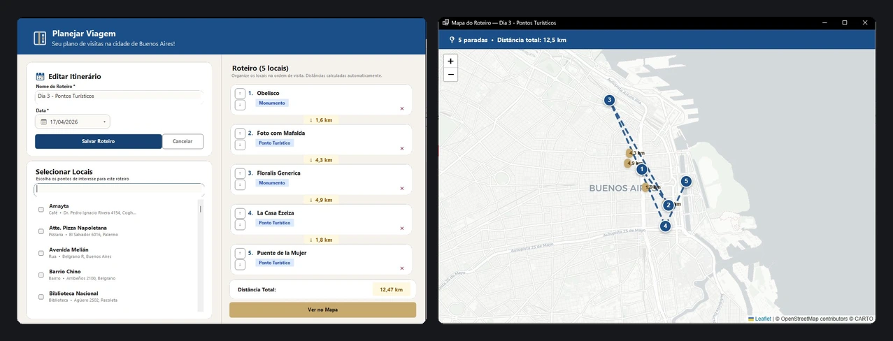
Buenos Aires Explorer
Buenos Aires Explorer is a desktop application in C# and Windows Forms for registering points of interest in Buenos Aires and planning visit itineraries, with an interactive map, distance calculation and PDF export. Version 1.0.0 is published, with a ready-to-download executable.
The Challenge
The goal was to explore desktop development with C# and Windows Forms, focusing on clean architecture, a custom interface and integration with external services, bringing location management, itineraries and map visualization into a single application.
Technical Highlights
The code is organized in layers (Models, Services, Views, UI and Data), with Entity Framework Core and SQLite for persistence and migrations. It comes to about 6,900 lines of C#.
The interface uses 7 custom visual components built on Windows Forms, such as RoundedButton and RoundedDateTimePicker, plus a custom theme with per-category colors.
The Nominatim API handles forward and reverse geocoding, and Wikimedia provides location images, searching by coordinates with a fallback to the title.
In itineraries, the user sets the order of the stops, and the application calculates per-leg and total distances with the Haversine formula. The interactive map uses Leaflet.js through WebView2, and itineraries can be exported to PDF with QuestPDF.